|
|
|
|
|
| |
| |
 |

Orange
represents courage and sacrifice.
Green
represents faith, fertility and chivalry.
White represents truth and peace.The Emblem in the center represents "Wheel of Life".
|
| |
| India Status |
Republic of India |
| |
| States Head |
The President |
| |
| Government Head |
The Prime Mininster |
| |
| Currency |
Rupee ( $1 = Rs. 49) |
| |
| Capital City |
New Delhi |
| |
| Country Code |
+91 |
| |
| Languages |
Hindi, English |
| |
| Electricity |
220 Volts 50 cycles A.C |
| |
| Visa |
Most Nationals |
| |
| Time |
+5.5 Hrs (No Daylight saving) |
| |
| Profile Largest Democracy in the world.�Seventh largest country in the world with a population� of over a billion. Constitution preceded with a Preamble.�Four climatic seasons - Winter, Summer, Monsoons, Autumn. |
|
| |
|
Temperatures 0C
/ 0F (Delhi - Kanpur Region)
|
|
Jan |
Feb |
Mar |
Apr |
May |
Jun |
Jul |
Aug |
Sep |
Oct |
Nov |
Dec |
| Min |
7 / 44 |
9 / 49 |
14 / 58 |
20 / 68 |
26 / 79 |
28 / 83 |
27 / 81 |
26 / 79 |
24 / 75 |
18 / 65 |
11 / 52 |
8 / 46 |
| Max |
21 / 70 |
24 /75 |
31 / 88 |
36 / 97 |
41 / 105 |
39 / 102 |
36 / 96 |
34 / 93 |
34 / 93 |
34 / 93 |
28 / 82 |
23 / 73 |
|
| |
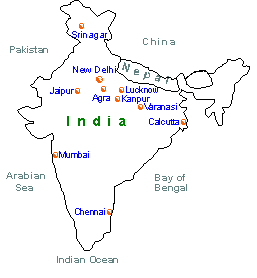
| Kanpur |
|
Administrative Headquarter of
Kanpur District, Kanpur formerly Cawnpore. City in Uttar Pradesh state, Northern
India, Southwest of Lucknow, on the Ganges river.With an area of more than 100 sq. miles
and a population of more than 3 million, it is the largest city of Uttar Pradesh and one
of the largest in India. An important road and rail hub and a major commercial and
industrial center. There is a military cantonment and an Airfield nearby. Kanpur has a
university, colleges of medicine, law and education; The Indian Institute of Technology
and a Government Experimental farm. Kanpur is irrigated by the tributaries of the Ganges
and the Yamuna rivers. Main crops include wheat, gram, jowar and barley.
|
|
| |
| |
|
|
|
| |
